
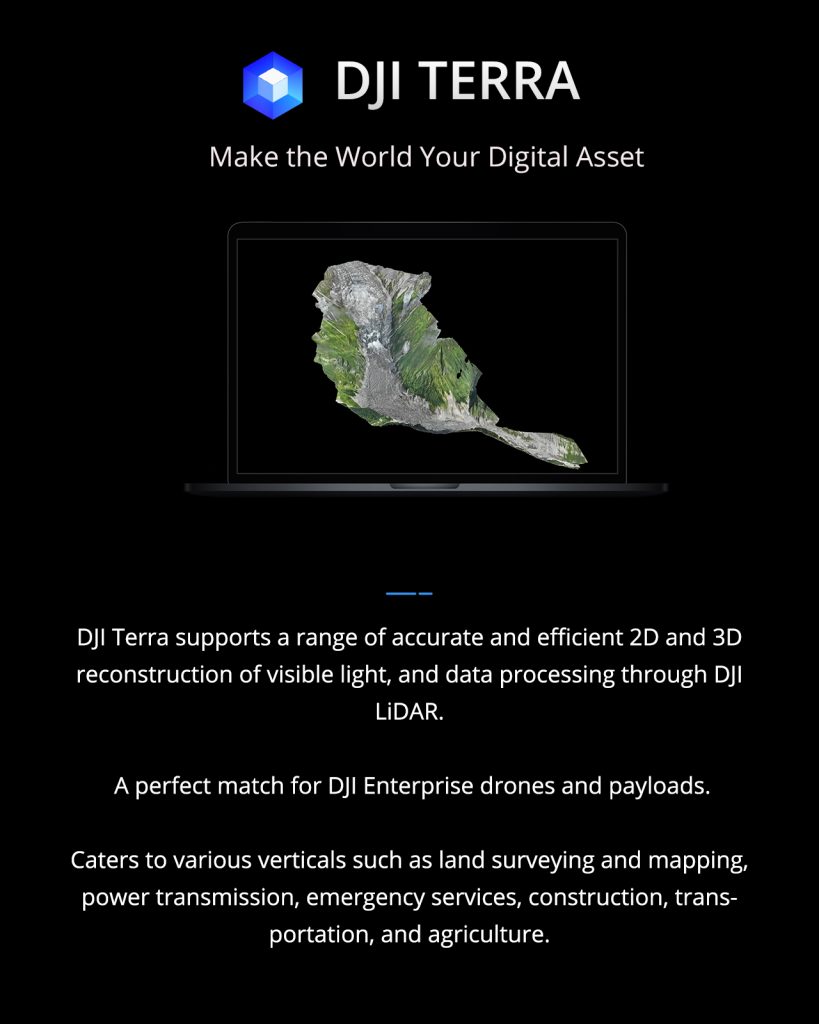
DJI Terra is a software designed for 3D model reconstruction, leveraging photogrammetry as its fundamental technology. It facilitates precise and efficient 2D and 3D reconstruction using visible light, alongside data processing via DJI LiDAR. This software is ideally suited for DJI Enterprise drones and their payloads, working seamlessly to create a comprehensive application solution tailored for diverse vertical scenarios, including land surveying, mapping, power transmission, emergency services, construction, transportation, and agriculture.
Sign up for a free trial of DJI Terra on the official DJI website to explore its features at no cost.
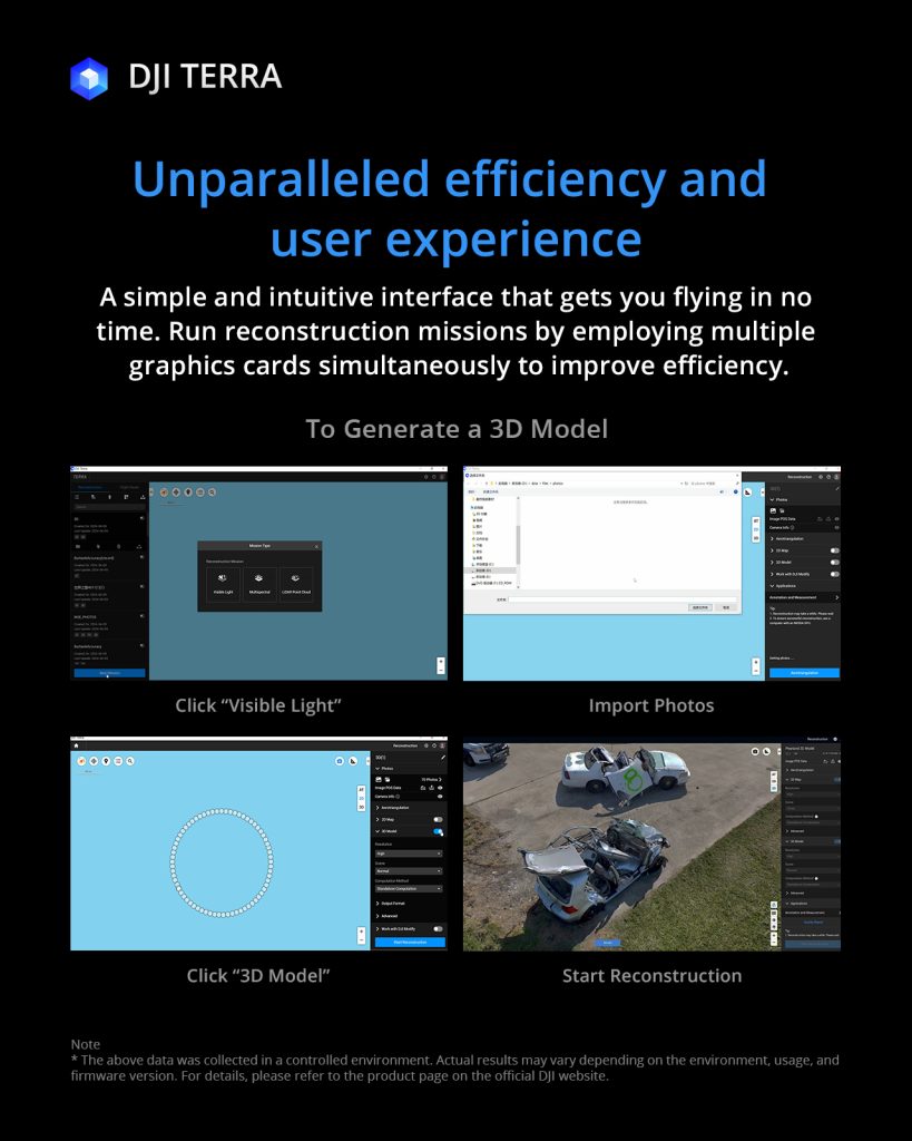
Install the DJI Terra to process and analyze aerial data captured by drones.
Get the user manual and sample data set to learn and practice using DJI Terra.
